Leaving the calm murky waters of Hinchinbrook Channel and the mangrove flats behind we headed out into the deeper cleaner Coral Sea with plans to tour the "Family Islands." First up was Cape Richards at the end of the very shallow bay at the northern tip of Hinchinbrook Island. So shallow that we had to anchor far from the beach. Looking back towards the distinctive mountains of Hinchinbrook:

The "Family Islands Group" is a small chain of small islands that were named after English families by Captain Cook on his voyage of discovery through here in 1770. We love idyllic little tropical islands with coral fringing reefs and coconut backed white sandy beaches (who doesn't?) and so we were super keen to explore as many of these islands as possible. None have decent protected anchorages but luckily the weather played along nicely and we had one of the calmest mildest weeks yet. The itinerary (ours not Cook's) was: Richards on Monday, Brook on Tuesday, Goold on Wednesday, Bowden on Thursday (with a brief excursion by dinghy to Smith and Hudson) and then on to Dunk for the weekend (with a lunch stop at Wheeler on the way).
These were all short little hops of an hour or two at most giving us plenty of time to go ashore and explore the islands and swim and snorkel off the beaches

Brook Island is our favorite place so far. It has a perfect little beach backed by palm trees and dense jungle covered hills with a long sandy spit extending into the sea.

It's a protected Marine Park with a rich coral reef with great snorkeling:


Rather than use our own anchor we were able to use a public mooring buoy. At the more precious coral reef sites these buoys have been installed by the Marine Park authorities for visiting boats to use because anchors damage coral. One always tries to anchor on sand or mud and avoid the coral but that is really hard to do in places like this where there is so much coral.

Goold Island was next. Closer to the mainland the water is a bit murky and not so inviting. The crocodile warning signs made us even more chicken. We didn't swim.

Instead we did a nice long beach walk

We found some fascinating fish traps among a few isolated mangrove trees. Built by Aborigines and possibly thousands of years old these low walls of stone and coral boulders in the inter-tidal zones leave fish trapped when the tide drops. Similar structures occur all over Australia and among them are some of the oldest surviving structures built by humans anywhere.


Bowden, Smith and Hudson form a triplet of almost identical islands.

All are small and circular, about half a kilometer in diameter. Each has a central rounded dome shaped hill, a small sandy beach on the western side and are otherwise ringed with big granite boulders along the shoreline.

They also all have some fringing coral reef and I did a bit of snorkeling but it was not spectacular. Most of the coral is dead and covered with algae.
We anchored closest to Bowden ...

... and visited the other two by dinghy.

The entire Great Barrier Reef is a marine park but it is subdivided into a complicated patchwork of zones with different levels of protection. In some areas you can't collect shells from the beach and in other areas you can drive 4x4 trucks on the beach. These three little islands and the waters around them are covered by relatively strict regulations and no fishing is allowed. In fact in this area one is not even allowed to have fishing rods or tackle out on the deck, they must be stowed away. In other areas there are limits to how many fishing lines you can have in the water, with different limits for different areas. Now that I am fishing I check up on the restrictions before each journey. While we were here a Marine Parks patrol vessel checked up on us. They are apparently very strict and penalties are severe. The rangers were professional and efficient, and very friendly once they were happy that I understood the regulations.

Wheeler is very seldom visited as it doesn't have a safe place to anchor. But we stopped anyway and went ashore and didn't stay long. It's a very beautiful island with a with a small secluded pristine beach.

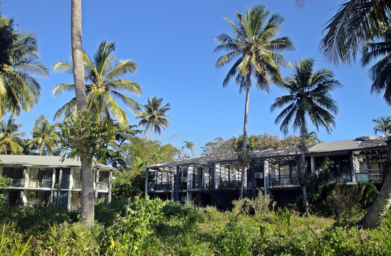
Dunk is much bigger than the other islands in the group. It is close to 'the mainland and gets lots of day visitors, arriving on a big public ferry, small private open boats and even rented jet skis.

It was developed as a resort, then destroyed by cyclone Larry in 2006 and then rebuilt. It was then destroyed again by cyclone Yasi in 2011, but that was after the global financial crisis and it now remains closed and ruined. The resort still looks fantastic from the distance

But from close up you can see that it is quite dilapidated and is slowly reverting back to jungle.
For us, coming from South Africa, it is remarkable that the place has not been looted and vandalised. This abandoned boat still has an outboard motor, a VHF radio and a sonar fish-finder!
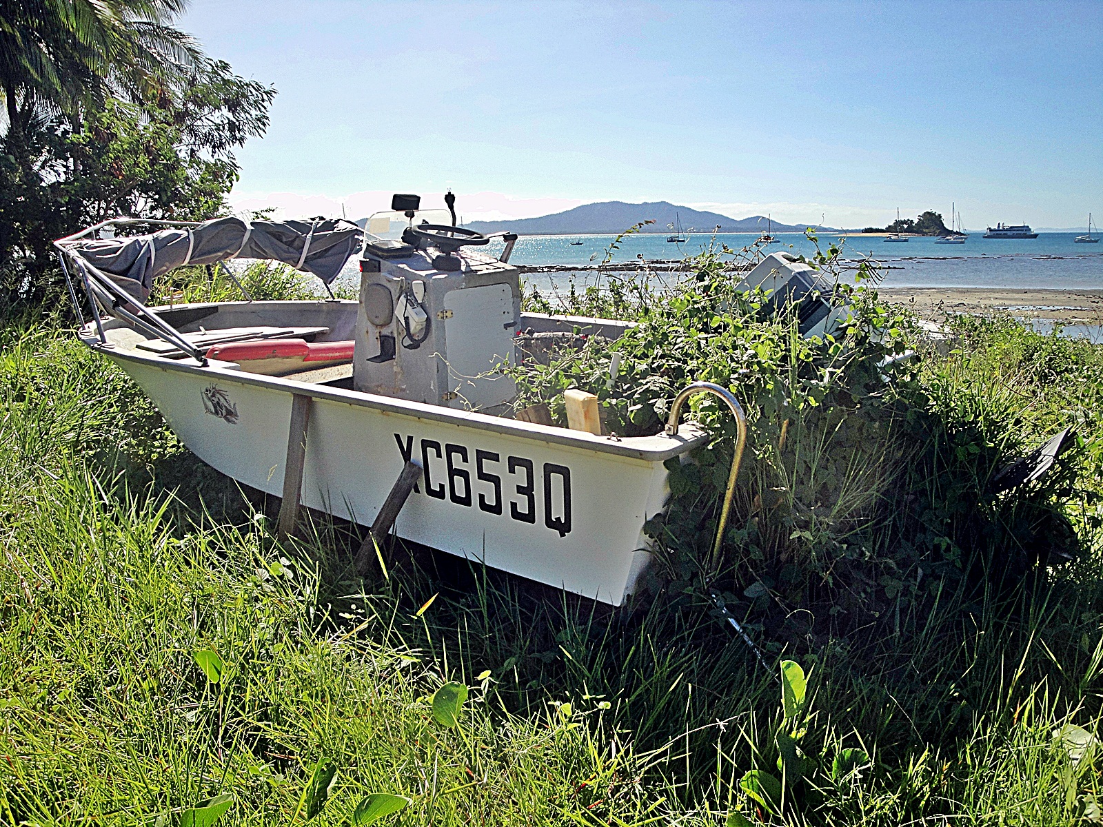
Quite sad really, but by far the majority of tropical Australian beach resorts that we have seen along the way have been in ruins. But there's still a beach bar here catering to day visitors, with tables and chairs and groovy music under the shade set up on the beach. It was tempting but at R75 for a beer we decided that a glass of wine on Pegasos would be nice way to end the day.
We spent three nights on Dunk which gave us two full days for walking the long beaches and longer jungle trails.


Next we visited a bunch of Barnard Islands, yet more dinky little circular islets each with a single central jungle covered hill and a west facing mini-beach and a fringe of coral. We did the two in the South (Stephens and Sisters) on Monday and the three in the North (Kent, Jessie and Huchison) on Tuesday. That's 12 islands in 8 days!
Anchored off Stephens ...

On Stephens we met a group of school boys on a kayaking and camping outing. What a fabulous school outing! Aussies do live well.

The sea continued to be flat and the winds calm, ideal conditions for taking the dinghy from one island to the next, exploring them all and their beaches and reefs. This is on Sisters looking back towards Stephens, at high tide.

This is on Stephens looking towards Sisters at spring low tide, looking back over the same stretch of water. It was quite interesting walking over the exposed reef and checking out the few live corals, seaweeds and sundry slimy marine animals trapped in the pools, mud and dead corals of the inter-tidal range. Not pretty, but interesting.

On Sisters we explored the mangroves. Even in this very shallow water, we surprised a small shark which did a quick circle around the dinghy and darted off to hide.


The jungle covered hill and sandy beach of Jessie, where we found more kayakers:

This pristine tropical wilderness is something of a kayaking nirvana with the islands being so close together and close to the mainland and of course there's coral reefs and warm calm water and mild weather.
The same paradise continues on Jessie, Kent and Hutchison.


By now (Wednesday 23rd) we've reached the end of this sequence of islands and we're running low on everything and we're out of chocolate (a crisis for me) and so tomorrow we'll be heading to the mainland for victuals.